
Getting oriented in Miami
Regarding geographical orientation, nowadays any mobile device with internet or a GPS can do the job. However, understanding the particular Miami areas and street numbering system can be of great help.
Despite the fact that Miami is divided into dozens of areas with official and unofficial boundaries, Miami’s layout may seem confusing at first, but with some tips, it quickly becomes easy to understand.
To understand the street numbering and how the FOUR sections of Miami are divided, you first need a reference starting point:
Mainland Miami is divided into four sections: North East (NE), North West (NW), South East (SE) and South West (SW).
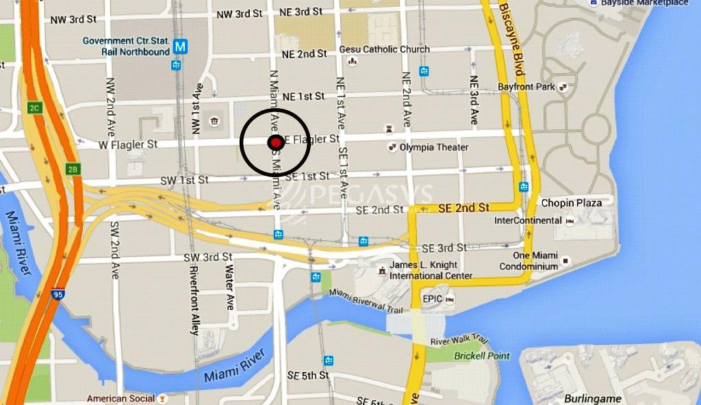
With his breathtaking skyline of luxury residential condo apartment and office buildings, Downtown Miami is the geographical heart and center of the city with its center point at the intersection of Flagler Street and Miami Avenue – the reference starting point for the street numbering system. Flagler Street divides Miami from north to south, and Miami Avenue divides the city from east to west. Therefore, any geographical point in Miami is referred to this “zero” point. For example Miami International Airport is located North West (NW), the beaches are North East (NE), and so on.
AVENUES generally run North-South, while STREETS go East-West.
There are exceptions to the system as Hialeah and Miami Beach. Hialeah needs a different map index. Many streets of Miami Beach have names as well as numbers that do not match exactly with those of the mainland.